Shimla
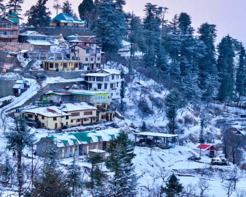
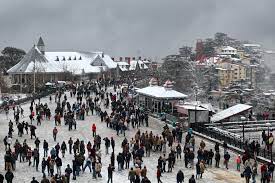
Shimla (2205m). the state capital of Himachal Pradesh, is one of India’s popular hill resort. Situated in the lower ranges of the Himalayan mountains. Shimla is surrounded by Pine, Deodar, Oak and Rhododendron forests. Towards the north lie the snow-covered high ranges, while the valleys breathe whispering streams and swaying fields. Within the town are host of splendid colonial edifices, quaint cottages and charming walks. Shimla offers a variety of shopping, sport and entertainment activities
Chandigarh is 117 km, Manali is 280 km & Delhi is at a distance of 370 km. From Delhi, Manali and Chandigarh, luxury coaches and taxis ply to Shimla. During the tourist season HPTDC also operates regular deluxe buses from Delhi and Manali to Shimla.
Visit-
Christ Church: The second oldest church in North India
Annandale (4.5 km): Surrounded by a thick deodar forest, this large glade has an ancient temple on the edge.
Sankat Mochan (7 km): This is a temple dedicated to Lord Hanuman.
TARA DEVI (11 km): 2044m, A thickly wooded hill with a temple dedicated to Tara Devi.
Kalibari Temple: The famous Kalibari Temple of Shimla is a popular tourist attraction and is situated at a very strategic location. The temple was built in the year 1845 and is dedicated to Goddess Kali who is also known as Shyamala. It is from the name of Goddess Shyamala that Shimla derives its name.
Jakhoo Temple: It is situated on Jakhoo Hill, 2.5 km from the Ridge, Shimla at a height of 2,455 m (8,000 feet) above sea level.[2] It is situated at highest peak of Shimla and offers a panoramic view of the Shivalik Ranges.
Mashobra (12 km): At 2149m, this beautiful suburb is surrounded by thick forests. From here, a track leads down to Sipur which is an exquisite glade shaded by ancient deodar trees.
Kufri (16 km): At 2501m, this is famous for its wide views and ski slopes. An enjoyable walk leads up to the Mahasu Peak. At Kufri, Himachal Tourism runs Cafe Lalit.
Fagu (22 km): At 2510m, Fagu has some enchanting views. Himachal Tourism run Hotel Peach Blossom offers spectacular views.
Chail (45 km): This was a former Summer Capital of the Patiala State. The Palace has been converted to a Luxury Hotel by Himachal Tourism.
Tattapani (51 km): At 656m, there are hot sulphur springs believed to have medicinal value.
Manali
Situated at an elevation of 2050m Manali is a perfect sojourn for adventure seekers. There are high mountains surrounded by snow and deep boulder strewn gorges. There are thick forests full of cool breeze and bird songs. There are fields of wildflowers, small picturesque hamlets and fruit laden orchards.
This hill station is surrounded with various spots that get you a taste of adventure and adrenaline rush. Some of the adventure activities that you can indulge in include skiing, paragliding, trekking, mountaineering, rafting, camping, downhill cycling, zorbing, snowboarding, and kayaking.
Visit-
Solang Valley: What’s Special: Adventure Sports; Scenic Views
Bhrigu Lake, Beas Kund, Mall Road, Hidimba Devi Temple, Rohtang Pass
Manali National Park: See Deodar Trees; Cedar Trees; Monal; Musk deer
Himalayan Nyingmapa Tibetan: Buddhist temple in Manali.
Chandrakhani Pass: High Mountain Pass.
Nearby Attractions: Manali; Beas Kund; The Great Himalayan National Park.
Gulaba: Picturesque landscape.
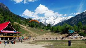
Kasauli
Located on the south-west part of Himachal and is on the relatively lower edges of Himalayas., Kasauli is a hilly cantonment town which makes for an ideal peaceful holiday location, away from the rush.
Nestled amidst beautiful woody forests of pine and cedar trees It’s home to gabled colonial-era houses, orchards and green-roofed Christ Church, dating from the mid-19th century.
At the southern edge of town, Monkey Point overlooks forests of horse chestnut and Himalayan oak. Nearby, the Gilbert Nature Trail winds through lush green countryside rich in birdlife.
Sarahan
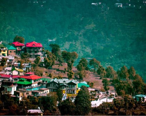
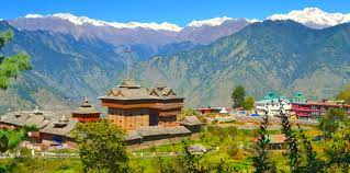
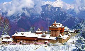
Sarahan is a small village in Himachal Pradesh of India. Though it is basically the site of the Bhimakali Temple, this beautiful hamlet is loved by nature lovers as well. The road to Sarahan winds past flowering Pine trees that give way to stately Oaks. Dozens of small streams rush past. The fields and orchards that surround the small villages with their slate roofed houses pastoral perfection. Above Sarahan, many deodar trees ride the slopes and higher still, encircling the Bashal peak, are trees of smooth birch and a variety of wild flowers and rare medicinal herbs. This sparsely populated tract is steeped in ancient legends and here is the famous Bhimakali temple regarded as one of the Fifty One sacred Shakti Peethas.
Kinnaur & Lahaul-Spiti Valley
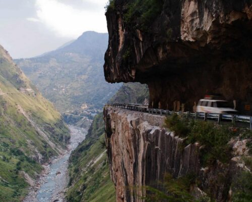
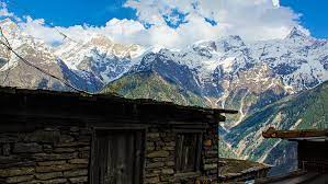
Kinnaur – the land of fairy tales and fantasies, has a spectacular terrain of lush green valley, orchards, vineyards, snow clad peaks and cold desert mountains. It is a border district of Himachal Pradesh. Kinnaur is also rich in flora & fauna. The culture and language is different from other parts of the state. Kinnaur, the tribal district of Himachal Pradesh, lies 250 km away from Shimla, the capital of Himachal Pradesh and is situated on the NH – 22 (Hindustan Tibet Road). The landscape of the area varies from lush green orchards of the scenic Sangla Valley to the stark magnificence of the Hangrang Valley. The massive snow clad ranges that provide a regal dignity to the scene are dominated by the peak of Kinner Kailash. Kalpa is one of the biggest and beautiful villages of Kinnaur. One can enter Kinnaur district at Village Chshora and follow a straight line road constructed in vertical rock and it is a rare treat to travel on this road which is a great engineering feat.
Nearest Airport (267 km) and Railhead (244 km) is at Shimla.
The route is on NH – 22 (The Hindustan Tibet Road) which bifurcates to Kalpa from Powari. Buses and Taxis are available at Shimla and Rampur. One can also reach Kalpa via Manali – Rohtang Pass – Kunzam Pass – Kaza (400 km).
Tourist Places
Kinnaur & Lahul-Spiti Valley
Kinnaur – the land of fairy tales and fantasies, has a spectacular terrain of lush green valley, orchards, vineyards, snow clad peaks and cold desert mountains. It is a border district of Himachal Pradesh. Kinnaur is also rich in flora & fauna. The culture and language is different from other parts of the state. Kinnaur, the tribal district of Himachal Pradesh, lies 250 km away from Shimla, the capital of Himachal Pradesh and is situated on the NH – 22 (Hindustan Tibet Road). The landscape of the area varies from lush green orchards of the scenic Sangla Valley to the stark magnificence of the Hangrang Valley. The massive snow clad ranges that provide a regal dignity to the scene are dominated by the peak of Kinner Kailash. Kalpa is one of the biggest and beautiful villages of Kinnaur. One can enter Kinnaur district at Village Chshora and follow a straight line road constructed in vertical rock and it is a rare treat to travel on this road which is a great engineering feat.
Nearest Airport (267 km) and Railhead (244 km) is at Shimla.
The route is on NH – 22 (The Hindustan Tibet Road) which bifurcates to Kalpa from Powari. Buses and Taxis are available at Shimla and Rampur. One can also reach Kalpa via Manali – Rohtang Pass – Kunzam Pass – Kaza (400 km).
Tourist Places
Kalpa
Situated at the height of 2758 m above the sea level and 110 km from Sarahan, Kalpa is a beautiful and main village of Kinnaur. Across the river faces the majestic mountains of the Kinner Kailash range. These are spectacular sights early in the morning as the rising sun touches the snowy peaks with crimson and golden light.
Recong Peo (2670m)
Located 240 km from Shimla, 7 km from Powari and 13 km from Kalpa. Recong Peo is the headquarter of district Kinnaur.
Kothi
Just 3 km from Recong Peo. Kothi has a temple dedicated to the goddess Chanadika Devi. Set against a backdrop of mountains and graves of the deodar the temple has an unusual architectural style and fine sculpture. An exquisite gold image of goddess is enshrined in sanctum.
Sangla Valley
If a landscape had the powers of casting spells, then the Sangla valley would be a magician extraordinary. Once seen, it is a place that can never be forgotten. Even the rushing waters of the Baspa river, that flow through its 95 km length, seem to absorb some of the magic and slow down to savor its snow-frame beauty. 2 km from Sangla is the fort of Kamru (300 m) its tower like architecture resembles that of the Bhima Kali complex and this was the origin of rulers of Bushehar. Chitkul (3450 m) is the last village of the valley and beyond lies Tibet.
Riba (2745M)
Just 18 km from Powari on NH-22 is famous for its vineyards and local wine ‘Angoori’ made from grapes.
Jangi
26 km from Powari, the inner border is located here beyond which foreigners require permit to travel upto Tabo. From this point the famous Kinner Kailash Parikarama Trek starts touching Morang, Thangi and Kunocharang villages and entering Chitkul village in Sangla Valley.
Puh (2837m)
Lush green fields, orchards of apricot, almond trees and vineyards, are to be seen on route to Puh. Just 58 km from Powari along the NH-22, Puh has rest house and basic hotel facilities.
Nako (3662m)
117 km from Kalpa. In Hangrang Valley is the largest village above sea level. It is also famous for Nako Lake which has boating facilities in summer and during winter its frozen surface is used for ice skating. Buddhist monastery is located here.
Tabo (3050m)
163 km from Kalpa and 27 km from Sando the ancient village, Tabo is situated on the left bank of river Spiti. Flanked on either side by hills, it is one of the most important Buddhist monasteries regarded by many as only next to the Tholing Gompa in Tibet. It is also known as the Ajanta of the Himalayas. Tabo is the largest monastic complex of Spiti which has since been declared a protected monument under the Archaeological Survey of India.
Kaza (3600m)
210 km from Kalpa 47 from Tabo. The headquarters of Spiti sub-district, Kaza is on the bank of river Spiti. In earlier times, it was the capital of Nono, the chief of Spiti. It has a Buddhist Monastery and Hindu Temple.
Key Gompa (4116m)
7 km from Kaza. The largest monastery in Spiti Valley. Established in the 11th century, it has ancient Buddhist scrolls and paintings. Also houses the largest number of Buddhist monks and nuns.
Kibber(4205 m)
18 km from Kaza. The highest village in the world which is connected by a motorable road and also the highest village in the world which has its own polling station during elections.
Kunzum Pass (4551m)
76 km: One of the highest motorable passes. Goddess Kunjum keeps guard over the pass and wards of the evil.
