Leh
Leh, the most important city and Headquarters of Ladakh district and Union Territory of Ladakh, is located in the Indus river valley on the old trading routes from Kashgar, Tibet, and Kashmir. Its importance as a trading town slowed down with the partition of British India, and ended with the closure of the border in 1962 during the Sino-Indian war. Since opening to tourists in 1974, it has become a bustling tourist town. Since 2000, domestic (Indian) tourists have started visiting Ladakh, with a dramatic increase since 2010. It’s a small town, easy to get most places by foot. The old town is a compact area of mud brick houses and narrow lanes directly to the east of Main Bazar. Changspa is the agricultural “suburb” northwest of the center, with many guesthouses. The main Bazaar’s elevation is 3505 meters, so take it easy on your first few days there or risk possible altitude sickness. Even experienced high altitude travellers (Andes) might have some trouble.
Nubra Valley
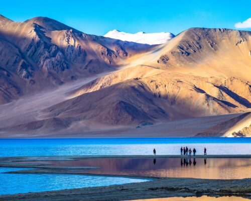
Nubra Valley (2800 m), nestled along the foothills of the Great Karakoram range is a great tourist destination of these days. Situated in theNorth of Leh the valley is drained by the rivers Nubra and Shayok. Nubra is a tri-armed valley located to the north east of Ladakh valley. Siachen Glacier lies to the north of the valley. The Sasser Pass and the famous Karakoram Pass lie to the northwest of the valley and connect Nubra with Uyghur (Mandarin : Xinjiang). Previously there was much trade passing through the area with western China’s Xinjiang and Central Asia.
It is said that its original name was Ldumra (the valley of flowers). The Shyok River meets the Nubra or Siachan River to form a large valley that separates the Ladakh and Karakoram Ranges. The Shyok river is a tributary of the Indus river. The average altitude of the valley is about 10,000 ft. Like the rest of the Tibetan Plateau, Nubra is a high-altitude cold desert with a rare presence of vegetation except the river beds. The villages are irrigated and fertile, producing wheat, barley, peas, mustard, and a variety of fruits and nuts, including blood apples, walnuts, apricots and even a few almond trees.
The usual route to access this valley is to travel through the Khardung La, (18,300 ft./5578 M), the highest motorable road in the world from Leh town.
Places to see in Nubra valley-
Samstanling Monastery
Diskit Gompa
Hunder Sand Dunes
Turtuk
Maitreya Buddha
Bactrian Camel Safari
Pangong Lake
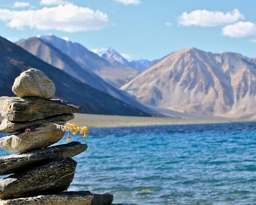
This famous lake is situated at an altitude of 14,100 ft (4,267m). It is 6 to 7 kms (4.5 miles) at its widest point, and over 130 kms (80 miles) long, and is divided by the international border between India (one-third of it lying in India ) and China only. Spangmik, the farthest point up to which tourists are permitted, is about 7 kms along the southern shore from the head of the lake. It presents a spectacular view of the mountains of the Chang-chenmo range to the north, their reflections shimmering in the ever-changing blues and greens of the lake’s brackish waters. Above Spangmik are the glaciers and snow-capped peaks of the Pangong range. Spangmik is a small village with a handful of families spread across a narrow stretch of earth between the lake and adjoining mountains. The blue expanse of the lake, stretching for more than 100km and spread across two countries, clearly dominates the local landscape. Pangong Chang-pa cultivates sparse crops of barley and peas in summer. It is in winter that they unfold their yak wool tents called rebo, and take the flocks of sheep and pashmina goats out to the distant pastures.
The lake acts as an important breeding ground for a variety of birds including a number of migratory birds. During summer, the Bar-headed goose and Brahmini ducks are commonly seen here. The region around the lake supports a number of species of wildlife including the kiang and the Marmot.
Tso-moriri
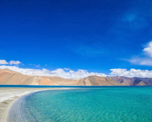
This barrenn hills of Ladakh is a desolate and extensive region known as Rupshu. Rupshu is a valley in southeast Ladakh, on the Leh-Manali highway. The altitude of the valley is between 4,500 and 5,500 metres. It is inhabited by the Changpa nomads.It is a landscape quite unlike any other in Ladakh, or elsewhere in India. This area is now open for tourists for visiting along two specified tour circuits.
The first tour circuit follows the Manali road over the Taglang-la upto Debring, a Changpa camping place. The route covers twin lakes Startsapuk-Tso and the Tso-kar, the Polo Kongka-la (about 16,500 ft /5,030 m) , Puga valley (Sumdo), then over to the head of Lake Tso-moriri.
The other route into the area follows the Indus to the village of Chumathang, where there is a hot spring. At Mahe, about 17 km further ahead, the road crosses from the north to the south bank of the river and then follows the Puga stream to join and follow the first circuit to Tsomo-riri via Sumdo.
Despite its barrenness Rupshu’s hills support a sparse population of wildlife, and the animal most likely to be spotted is the Kyang, the wild ass of the Ladakh and Tibetan plateaus. More plentiful are marmots (ubiquitous to mountain slopes all over Ladakh), hare, and an unusual tailless rat. The lakes are breeding grounds for numerous species of birds. Chief among them is the bar-headed goose, found in great numbers on the Tso-Moriri, the Great crested grebe, Brahmini duck, Black-necked Crane and Ruddy Shelduck.
Srinagar
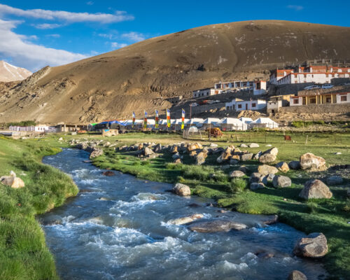
While visiting Srinagar, visit the famous lakes . The popular Dal Lake is one of the most beautiful and visited lakes in the world. The lake surrounded by mountains, blossoming gardens and orchards, leaves you speechless. Try a pleasant ride in Shikaras and Houseboats. Subsidiary to the Dal, another famous water body is Nagin Lake, mostly visited for swimming, diving and boating.
As you walk over the Takht-e-Suleiman hill, you will find the Shankaracharya Temple. This temple, dedicated to Lord Shiva, is supposed to be the oldest shrine of Kashmir valley.
The landscaped Mughal Gardens are a paradise for nature lovers. Developed by the Mughals, Chashmashahi Garden, Nishat Garden and Shalimar Garden are the three places that blossom with some of the rarest flowers in the world.
The nearby hilly areas provide opportunities for fishing, golf, mountaineering, skiing, trekking, river rafting, paragliding, aero sports, backpacking, canoe trips, camping and kayaking.

Pahalgam
Pahalgam is a tourist town and a notified area committee in Anantnag district of the Indian union territory of Jammu and Kashmir. It is a popular tourist destination and hill station. Its lush green meadows and pristine waters attract thousands of tourists from all over the world each year. It is located 45 kilometres (28 mi) from Anantnag on the banks of Lidder River at an altitude of 7,200 feet (2,200 m). Pahalgam is the headquarters of one of the five tehsils of Anantnag district. Pahalgam is associated with the annual Amarnath Yatra. Chandanwari, located 16 kilometres (9.9 mi) from Pahalgam is the starting point of the yatra that takes place every year in the months of July–August.
Pahalgam is famous for its scenic beauty and is the jewel of the picturesque Liddar valley located in the high Himalayas. It provides an ideal setting for activities like hiking, trekking, and fishing. Pahalgam is a part of Asia’s only saffron growing area.

Gulmarg
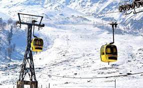
Gulmarg is a wonderland for adventure sports lovers. The northern Pir Panjal Range is considered a perfect location for trekking. During your trip to Gulmarg, you have the privilege to visit the highest golf course in the world. The golf club was started by the British in 1904. Apart from this, it is also counted among the best skiing resorts in India.
Khilanmarg is a wonderful valley that provides a panoramic view of the majestic Himalayas. The air is aromatic because of countless colourful flowers. You will feel refreshed in the atmosphere of Khilanmarg valley.
Near the Apharwat peaks, flows the Alpather Lake. This alpine lake remains frozen till mid-June. Alpather Lake makes an exciting day’s excursion for horse riding fans.
Several tourists visit the shrine of Baba Reshi to pay a holy tribute. This Muslim shrine, built over the slopes below Gulmarg, witnesses thousands of devotees every year.
Patnitop
Finding beautiful plateaus and dense forests at a height of 2024 m from the sea level is itself a great attraction to draw tourists from the world around. People love to visit the Chenab Basin, formed by the Chenab river and mountains. The place is covered with a thick layer of snow in winters. Chinar garden and saffron fields provide a picturesque view of divine natural beauty.
People can go skiing, paragliding, camping, walking and trekking at Patnitop. Visit the Sudh Mahadev, a holy place near Patnitop. Several other religious holy places near Patnitop are Naag Temple, Vaishno Devi Temple, Buddha Amarnath Temple, and Bahu Fort & Temple.
Patnitop is located in the Shivalik Belt of the Himalayas, Udhampur District on NH 1A. Sanasar, 20 km from Patnitop, the mini Gulmarg, is a wonderful hill station in the state of Jammu and Kashmir. The town is built in a cup-shaped meadow surrounded by gigantic conifers. Recently, it has been developed as a golf course for its tourists. While visiting Sanasar, you are provided opportunities for paragliding, parasailing and horse riding also. All these adventure sports activities are controlled by J&K government authorities. The place is a paradise for those who want to explore their latent sporting spirits and sportsmanship. It is particularly famous for the wide range of sporting activities.

